About the Rodeo Sanitary District
District at a Glance
The Rodeo Sanitary District serves the unincorporated communities of Rodeo and Tormey adjacent to San Pablo Bay. The District provides wastewater collection, treatment, and disposal services, and contracts for solid waste collection service for Rodeo with the Richmond Sanitary Service.
The Rodeo Sanitary District currently operates and maintains 25 miles of pipeline with two force mains and two pump stations. The District’s Water Pollution Control Plant (WPCP) has a design capacity of 1.14 million gallons per day (mgd) and average dry weather flow of 0.60 mgd. The Rodeo Sanitary District, the City of Pinole, and the City of Hercules share discharge facilities to San Pablo Bay through a Joint Powers Agreement.
District Organization
The Rodeo Sanitary District is an independent Special District of the State of California, formed in 1939 pursuant to the Sanitary District Act of 1923 (Health & Safety Code §6400 et seq). The District is a public agency administered by a duly elected five-member Board of Directors. The Board currently meets monthly on the second Tuesdays of each month at 1:30 PM to discuss the business of the District. Members of the public are welcome to attend these public meetings.
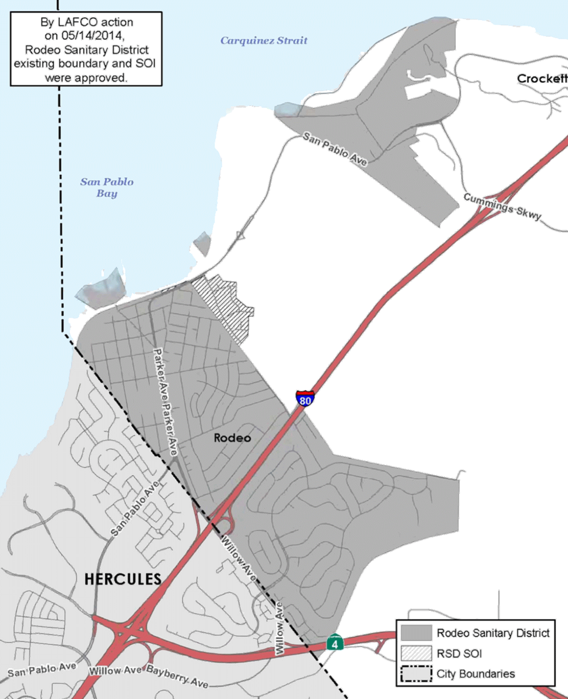
District Boundaries & Sphere of Influence
Municipal Service Reviews (MSRs) were added to LAFCO’s mandate with the passage of the Cortese-Knox-Hertzberg (CKH) Local Government Reorganization Act of 2000 (Government Code § 56000 et seq). An MSR is a comprehensive study designed to better inform LAFCO, local agencies, and the community about the provision of municipal services. Service reviews capture and analyze information about the governance structures and efficiencies of service providers and identify opportunities for greater coordination and cooperation between providers. The MSR is a prerequisite to a Sphere of Influence determination and may also lead a LAFCO to take other actions under its authority.
Map of District Boundaries